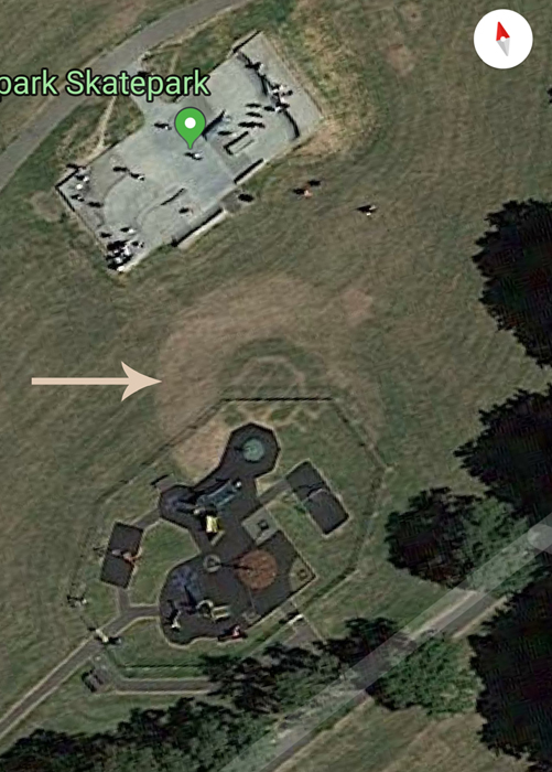
A reader, Libby got in contact recently to ask about a strange feature that’s appeared on Google Maps in Victoria Park.

This seems to be the foundation for a bandstand. On the map section of the Somerset HER, an RAF survey from 1946 (Go to the maps tab, then use the maps dropdown option) shows this feature standing, surrounded by war-time allotments. An aerial view of the whole park in 1932, including the bandstand can be seen here.
Squibbs’ History of Bridgwater mentions (p.125) that the Town Council spent £2,050 laying out Victoria in 1928. This was about the time that the Newtown Estate along Kendale Road was built. The land had been in use as a Rugby ground well before 1904, when it was recorded on the OS survey.

Will Locke’s Times Remembered of Bridgwater in the 1920s and 1930s mentions:
Victoria Park was originally called Malt Shovel Park when the area was at least twice the size it is now… I recall in 1922 a fairly large stand (near where the Kendale Road bungalows now stand), being dismantled… A park bandstand in Victoria Park was in use for about ten years, 1936 to 1946, and then dismantled. The hard tennis courts were constantly in use, as was the bowling Green (Victoria Bowling Club).
Locke later mentions how the spectator stand had been given by a Mr Saunders, a local wicker works owner, who was a keen Rugby enthusiast.

MKP 25 January 2020
