Streets, roads and lanes in Bridgwater starting with the letter ‘V’.
Valetta Place: Named after the capital of Malta. Exactly why so named is unclear. Possibly because of the town’s trading connections, possibly in commemoration of the British capture of Malta in September 1800. The date of this pretty set of buildings is unclear, as this area is a blindspot for the various early maps we have for the area. The first definitive appearance is on the 1841-1854 Map of the western side of the town. There were originally five more properties, although these were demolished for the GWR railway line to the docks. Originally reached via West Quay, only a footpath connected it to Northgate (Town Guide Plan, 1978). Presumably re-routed in the 1980s with the building of Chandos Bridge.
Vearncombe’s Cottages: A small court on the north side of Prickett’s Lane/Market Street, located directly behind surviving numbers 23-25 Mount Street (which are also shown on the 1888 OS Town Plan). Not on the 1853 Town Plan, but shown and named on the 1888 OS Town Plan. Still standing in 1904, although one of the cottages had been demolished by 1930. Probably No.2 Court mentioned in the 1937 Whitby Light and Lane Directory. Presumably demolished in the 1980s to make way for the Angel Crescent shopping centre, if not before. Presumably named after the builder/owner. A Francis Vearncombe was a boot and shoe maker of St Mary Street listed in Whitby’s 1883 Directory.
Verona Court: NDR development, under construction in 2006. One of a series of names taken from places in Italy.
Vicars Lane: Wembdon. This lane is the former driveway to Hillgrove House, which served as vicarage for Wembdon for many years. Also see Orchard Lane. Hillgrove is on the 1840s Tithe Apportionment Map, and presumably dates to sometime in the half century before this.
Vickery Close: Modern development, date TBC. Built over the site of Pound Farm and the medieval hamlet of Haygrove. Name of unknown significance.
*Victoria Road: Called Kidsbury Lane on 1835 Boundary Reform Map (see Kidsbury Road) and Malt Shovel Lane on the 1868 Boundary Reform Map, in reference to the Inn (which is first mentioned in 1785). The row of houses there are called Washington Terrace on the 1888 OS Maps, although this seems only have applied to the housing rather than the entire road. Named in honour of Queen Victoria, it seems sometime after the 1888 OS map, possibly at the time of her diamond jubilee in 1896, if not for her golden jubilee in 1887. A counterpart to Alexandra Road. In older documents this is referred to as the Drove in 1813 and 1819, a way for driving and hearding livestock (SHC DD/OS/7).
Victoria Street: See Queen Street.
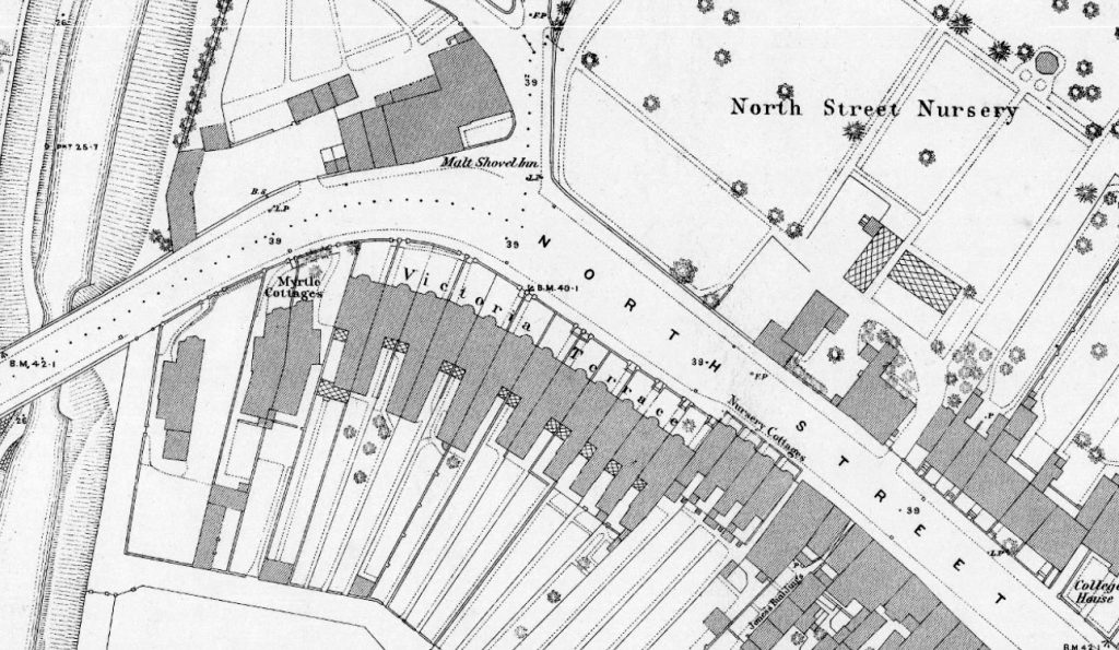
Victoria Terrace (North Street): a row of Victorian houses on North Street, built sometime between the 1854 Town Plan and the 1888 OS Town Plan. Built over land previously owned by the Town Council (described in the 1835 Borough Property reports). Named after Queen Victoria, but before Victoria Road: on the 1888 OS map that was still called Malt Shovel Lane.

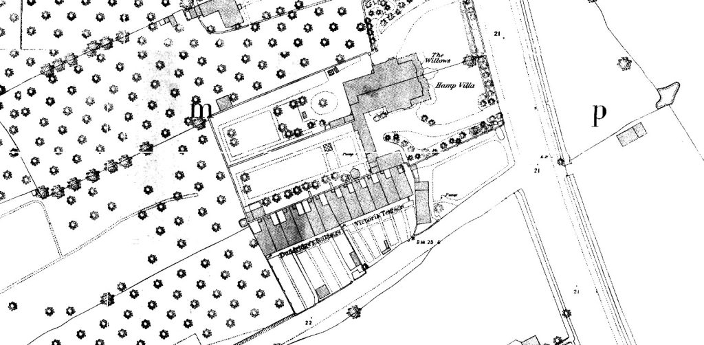
Victoria Terrace (4 to 14 Rhode Lane): a Victorian terrace, presumably named after the queen. Shown as proposed/under construction on the c.1854 Town Plan alongside the adjoining Duddridge’s Buildings (16-26 Rhode Lane). Seem to be called ‘Sealy’s Buildings’ in the 1891 Census, presumably after the builder/owner. Called Victoria Terrace in the 1901 census.

Vienna Way: Post 2006 Stockmoor Estate, date TBC. Presumably named after the city in Austria, once the imperial capital of the Hapsburg Empire. Given the names of the rest of the estate, this could be a type of Livestock.
Violet Path: Post 2006 Willstock Estate, date TBC. Named after a type of plant.
Viscount Square: Modern NDR development, complete by 2006. One of a series of names taken from aristocratic titles.
