Preliminary Notes on Bridgwater Building Stones
Geology
The medieval town is largely underlain by a compact competent Pleistocene or Recent red gravel, with some yellow clays.
There were probably no building stones available by quarrying within the settlement.
To the north-west, at Wembdon, are fault-bounded outcrops of red sandstone of the Permo-Triassic.
Further to the north-west near Cannington are small inliers of Carboniferous limestones and sandstones.
To the north-east lie the Polden Hills where the grey limestones of the Lias are readily quarried at the surface.
To the south-east are the ancient quarries of the Ham Hill golden-yellow ferruginous limestones (Jurassic).
Transport to Bridgwater
The western building stone (Red Wembdon Sandstone, Carboniferous limestones & sandstones) – by cart & track.
Lias Limestone – by cart & track to Downend or Crandon, thence on the Parrett upsteam to Bridgwater: or by cart and track to the Town Bridge or Lyme Bridge(?).
Ham Stone – on the Parrett downstream.
From Doulting, nr Wells, pale oolitic limestones may have been transported by road to Bridgwater.
Some high-status buildings (e.g. St Mary’s Church, Friary Church, Friarn Street) may have been slated-roofed, the slate (stone tiles) possibly brought by road from near Wiveliscombe or Rooks Castle.
Documentary evidence for use or reuse of stone
Dilks: Bridgwater Borough Archives, Somerset Record Society
town wall (muro super fossatum ville de Brig’Walteri), 1302 (No. 53)
lime (lim); chalk, 1336 (No 123)
carriers of rubble stone (petrarum rubylla); carrier of stone, 1366 (No. 238)
masons; hauling stone to the church, 1373 (No. 297)
4250 stone tiles from Rooks Castle* (near Broomfield) for the church(petris tegularibus apud Rokescastel) Sand from Boarshead 1394 (No. 475)
*Ussher WA E: Mem. Geol Survey Explanation of Sheet 295 The Geology of the Quantock Hills and of Taunton and Bridgwater London: HMSO 1908, page25. Middle Devonian. “South of Boomer there are large quarries, exposing about 100 feet of grey green and lilac irregular slate and slaty grit with very hard beds of fine-grained grit… Similar rocks .. are exposed in a small quarry on the north side of the stream, west of Rooks Castle Wood”.
Sand from Wembdon (apud Wembdon pro porta …. arene) 1397 (No. 483)
.. and numerous later references
Leyland (1540-42) “The Waulles of the Stone Houses of the Toune by yn steede of the Towne Waulles”. “There hath faullen in ruine and sore Decay above 200 Houses yn the Toun of Bridgwater in tyme of rememberaunce.”
Franciscan Friary (to the W.) and Hospital of St John (to the E.) surrendered 1538. Castle slighted and many streets set alight 1645. (Jarman, Powell). So, several sources of stone for re-use likely.
Archaeological descriptions
Ellis, P et al Excavations at Friarn Street and West Quay Bridgwater SANHS 1985, vol129, pp69-80 for description of stone found in castle walls.
Observations of standing walls
General
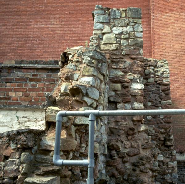
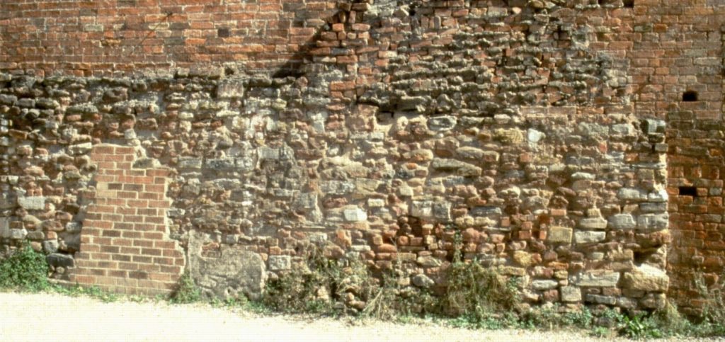
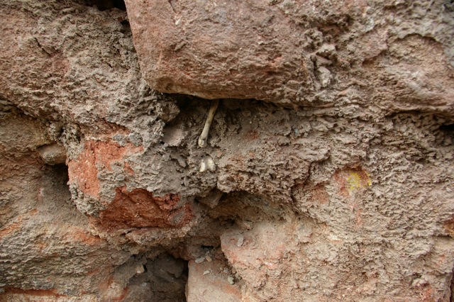
The oldest walls (castle, church tower) contain a high proportion of red sandstone. Edge detail is Ham Stone or lighter sand/limestone. Mortars generally pink.
Castle walls contain occasional conglomeratic boulders. These rare elsewhere.
Grey lias appears intermingled with red sandstone in later medieval walls. Perhaps this is a reflection of improved communication – the Town Bridge – and the recognition of the better qualities of the stone.
Misplaced Ham Stone a clear indicator of re-used stone – likely to be post medieval (but may be earlier).
(Some) known locations of medieval stonework in Bridgwater
St Mary’s Church
Castle Wall on West Quay

Chandos St Houses (red sdst; some reused)
Queen St Castle wall; 2/4 Queen St cellars

Castle Street cellars(? – needs survey)
Horsepond Lane – 2-storey lias blocks; W corner base front of Purnells; red/grey/ham blocks at base of W boundarywall
32 Friarn St: side & rear elevations to first floor level; front to 1m height mixed lias & red


30 Friarn St at base of front elevation PO car park at base of burgage boundary wall with Old Vicarage
Rear & side elevation of Friarn St quarter burgage plots by Harris Motors
Old Vicarage – property notes here.
Bridgwater Arms elevation by Baptist Church
Basements of Friarn Lawn properties
Silver Street (Browns Glass), and suspected mid 17th c. cottage at Friarn St end
Rear of High St Kebab House & nearby (reused)
High St pubs etc – several
Horlock/Orlieu St (=Clare St) – car park opp. Town Hall; rear elevations of High St properties; Music Shop (? to mid Gable)
Pynel St (=Market St) Tamlyn’s North Saleroom ; fragments opposite, too
High St: Tourist Information Centre (extensive) [- now part of the Engine Room – MKP 2020]

King St basal side elevation Fore St end
Blake St : several, incl. Old Mill (derelict Listed); Blake Museum (extensive)
Dampiet St: excavations of corner shop; stone cellars neighbouring. The back of the Unitarian Chapel (see below).

George St – to plinth level George Hotel; also north curtilage wall
St Mary St by Bramley & Dines adjacent Megabowl

Dr Peter Cattermole 17 June 2009.