This set of digitised historic maps of Bridgwater are set in chronological order. If you have any to add, please get in contact.
J. Stuart Dilks’ Recreation of Medieval BridgwaterJack Lawrence’s 1978 interpretation of Medieval Bridgwater
1735
John Stratchey’s Plan, believed to be circa 1735. Note this map has west at the top. collection A P Woolrich
1802
Detail from the 1802 Ordnance Survey Drawings of Burnham on Sea (British Library OSD 43-2) The original, much larger map can be seen here. Emphases on these maps was given to the road layout, while village names were less of a concern (hence ‘Dunmore’). Parts were left unfinished, hence the void areas.
1819
Town Plan of ca. 1819 collection Mr J Stuckey
1824
Contract drawing for town water supply of 1824 collection A P Woolrich
1835
Bridgewater showing new (red ) and old (green ) borough boundaries, as part of a set of four towns (the others are Frome, Taunton and Wells), 1835. The whole is plate LXXV published in Samuel Lewis’s Topographical Dictionary of England steel engraved by J. & C. Walker and drawn by Robert Creighton. The borough plans were produced by Creighton to illustrate the former and present boundaries of cities and boroughs in relation to the great Reform Act of 1832. Steel engraved. Hand coloured. Printed area 10in x 7½in (approximately) overall (four plans). collection Dr P E Cattermole
1853
Map of the District five miles around the town of Bridgwater, by Thomas Clark and Robert Down. 1853. collection of the Blake Museum, (copies available from the museum shop)
1854
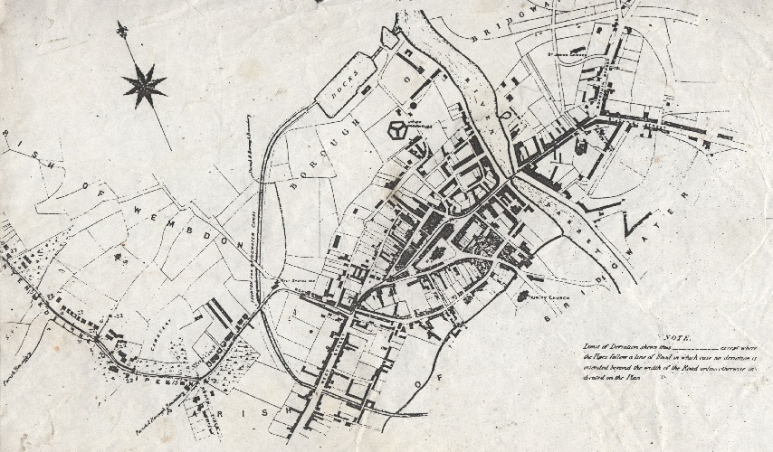
Plan of the western side of the River Parrett. This is post 1841 and the completion of the docks. This is pre 1854 and the demolition of the Island in High Street. However it also appears to post-date 1854 and the building of Theatre Place – that year being when the Theatre’s licence was revoked. Reproduced courtesy of Bristol Record Office RefNo.:31965[STG]/11, digitisation funded by the Blake Museum, Bridgwater
1865
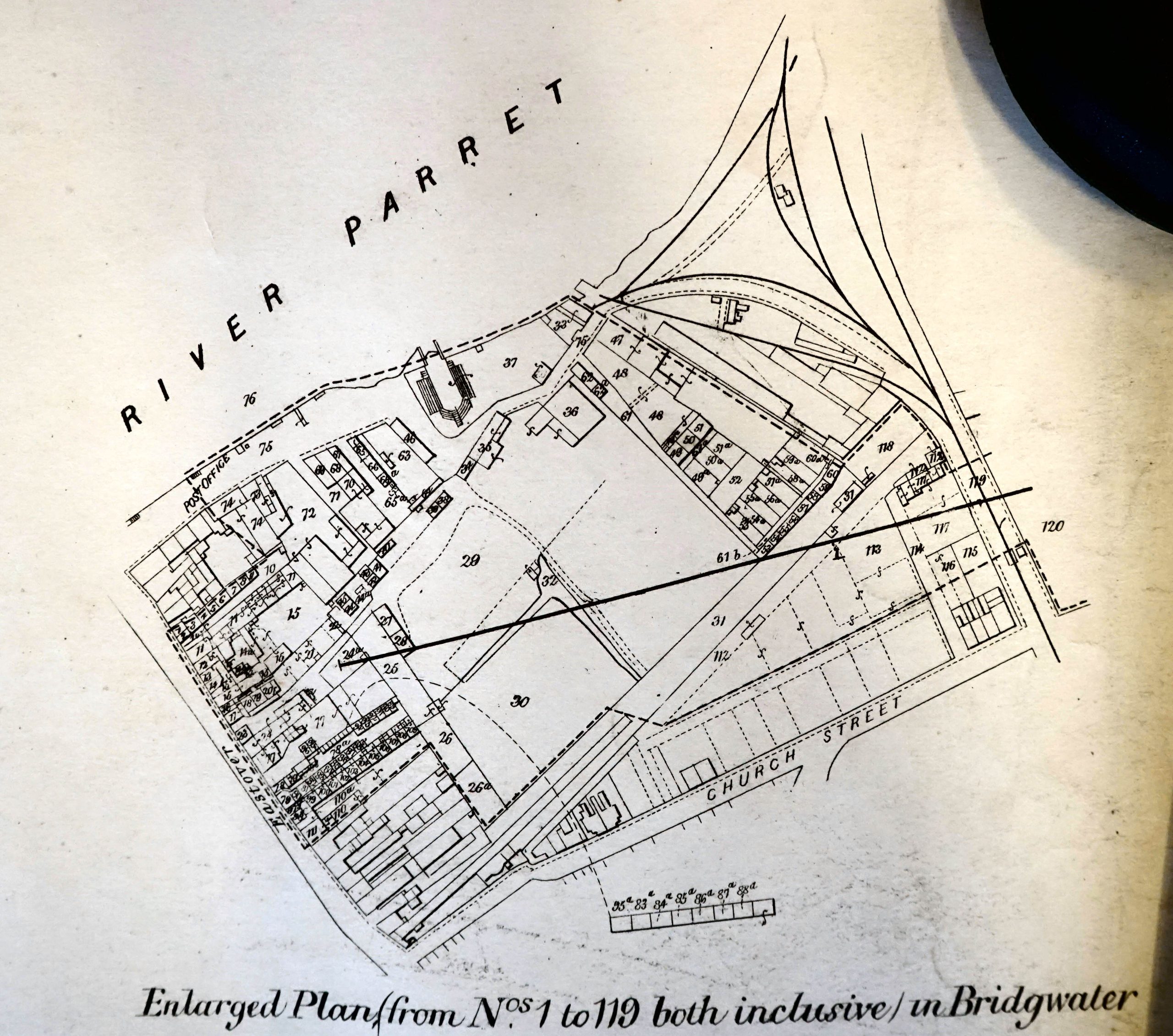
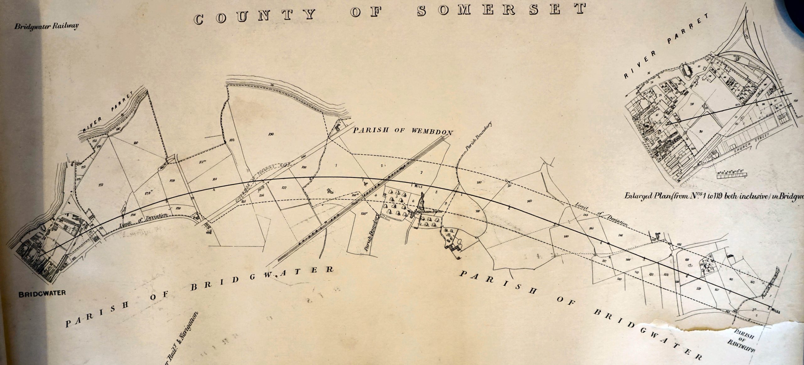
Part of the North Side of Eastover. Part of the Petition to Parliament for a new railway, read the full survey here. Kindly supplied by David C. BownEastover to Bawdrip from the same survey.
1868
Ordnance Survey Parliamentary Boundary map of 1868 collection Dr P E Cattermole
1875
An extract of a larger map of c1875 by Thomas Hawksley, (1807-1893) Hawksley was consulting engineer to the Bridgwater Borough Water Committee, which shows the extent of the town then. Water was pumped from Ashford waterworks to the reservoir of Wembdon Hill. From there it flowed by gravity in the water mains down Wembdon Hill to the Maltshovel Inn, then by way of North Street, Penel Orlieu, High Street, Fore Street, Town Bridge and Eastover, ending at the junction of Monmouth Street and St John’s Street. Supply pipes would have gone from the main to nearby roads.
1883
Plan in the 1883 John Whitby & Son’s Handy Directory of Bridgwater & Neighbourhood
1887
For the 1887 Ordinance Survey 25 inches to the mile, see the website of the National Library of Scotland. See, for instance, here. Or the Somerset HER Maps section.
1900
Map accompanying John Whitby & Son’s annual Directory of Bridgwater, c.1900 As well as the six buildings marked by figures it shows the locations of schools and places of worship and the railways.
1904
For the 1904 Ordinance Survey 25 inches to the mile, see the website of the National Library of Scotland. See, for instance, here. Or the Somerset HER Maps section.
1928
Town Plan from the 1928 Town Guide
1930
For the 1930 Ordinance Survey 25 inches to the mile, see the website of the National Library of Scotland. See, for instance, here. Or the Somerset HER Maps section.
1930
A Town Guide Plan, 1930. Before the Cattle Market moved in 1935, before the Hamp estate, but after the first phase of the Newtown Estate.
1935
Bridgwater Directory Almanack and Tide Table 1935.
1939
A Town Guide Plan, circa 1939/40
1946
For the RAF photographic aerial survey, see the Somerset HER Maps section.
1957
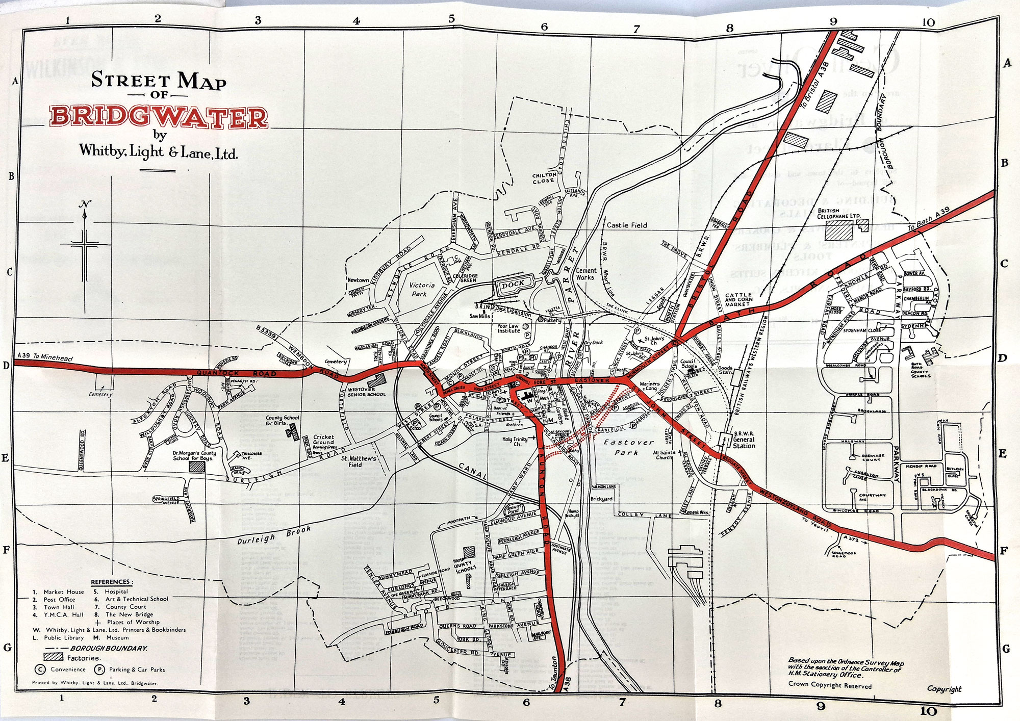
Fold out map from the 1957 Town Guide.
1960
1960 Colley Lane Industrial Estate, taken from that year’s Town Guide


.jpg)