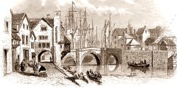
St Saviour’s House was named after the medieval chapel of St Saviour’s (sometimes St Savery, or Salvery). Both are now gone, and both poorly documented, but we can get a glimpse of both from fragments of evidence. No photographs seem to survive of the house. Saint Saviour is another name for Jesus Christ.
St Saviour’s Chapel
In the 1540s the antiquarian Leland mentions ‘Entering into Bridgwater I passed by a Chapelle of S. Salvior standing on the Ripe of the Haven.’ He also says ‘The Chapelle of S. Salviour at the South side withoute the Town was buildid in hominum memoria [living memory] by a Merchaunt of Bridgewater cawllid William Poel or Pole.‘
‘Ripe’ meant at that time the edge of a river or stream. ‘Haven’ probably means estuary, and possibly refers to way the Durleigh brook leading to the Parrett. The chapel is not mentioned by a previous visitor to Bridgwater, William Worcestre, which suggests the chapel was built sometime between 1485 and 1530. It was served daily by one of the Friars and was possibly for the use of travellers arriving from the south (Lawrence, History of Bridgewater, 56).
In the late 1530s the English Reformation made the chapel redundant. Given it had only recently been built, it was presumably repurposed, although by who and what is unclear. In 1581 it seems to have been used as a depot for four boat loads of stone for the mending of the causeway (ie Old Taunton Road).
There are mentions of the chapel in various documents through the eighteenth century. One set locates a tenement near St Saviour’s near the South Gate and the Almshouse – this property is probably now 2 Old Taunton Road (SRO DD/X/CYS/1). The chapel was still standing in the 1770s (SRO D/B/bw/1971), when there is mention of repairing the sluices at the chapel. Again this would indicate that it was somewhere along the Durleigh Brook, and presumably upstream of the Town Mill (which would need sluices to control the flow of water).
The 1735 plan of Bridgwater seems to show a large oblong adjoining the Durleigh Brook and South Gate – the only building in the area we might expect the chapel to have been. The 1735 map in itself is not especially reliable though, but this seems to be supported by later map evidence.
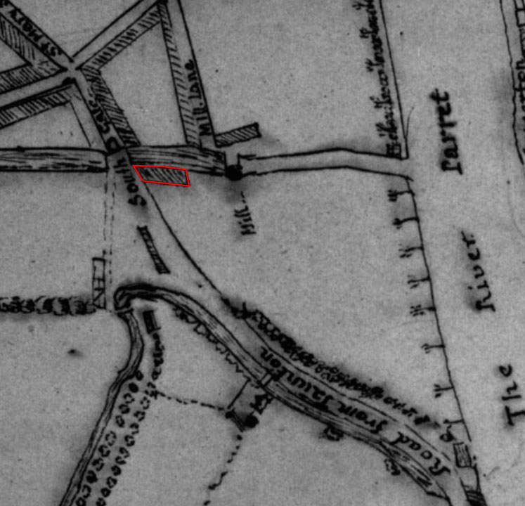
That building from the 1735 map does appear on the 1810s Town Plan and what is presumably the core of the new St Saviour’s House next to it. We might assume therefore that the building close to Taunton Road might #represent the old chapel.
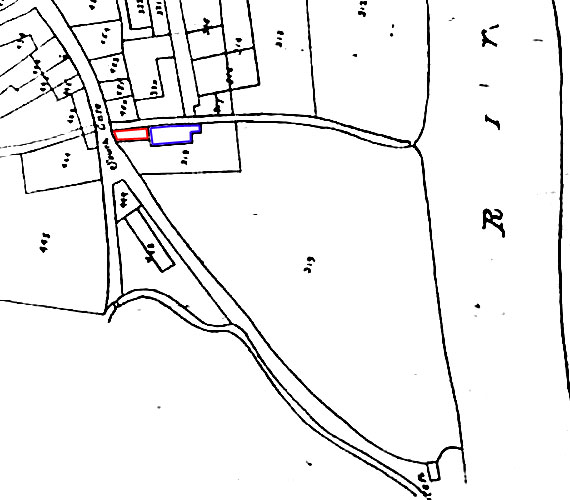
By 1824 the possible chapel rectangle seems to have been demolished. A possible context for this may have been the 1822 when the turnpike road (Old Taunton Road) was improved and the nearby South Gate was demolished for road widening (Dunning, VCH). By this time the garden of the house had been extended as a large triangle, which may been been compensation for the loss.
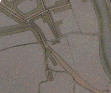
Whatever this building was, its foundations were found in 1992, when workmen discovered two parallel walls one metre under the pavement, ten metres apart, made of red Wembdon sandstone and one metre thick (Chris Sidaway, PSANHS, 135, 1992, p. 172). Given the thickness of the walls, this building presumably survived the Civil Wars of the 1640s, when the South Gate was fortified, by being turned into a blockhouse.
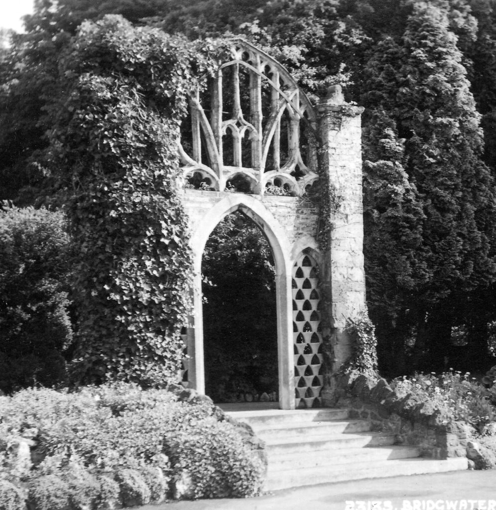
If this building was St Saviour’s Chapel, and survived as late as the 1810s or 1820s, it may have provided, through architectural salvage, the arch in the gardens of Binford House, later Blake Gardens (usually assumed to be from St Mary’s):
St Saviour’s House
The exact date of St Saviour’s House is unclear, but it seems to have been built by the time of the 1810s Town Plan above. Only a small section of the house survives, which can be seen from Blake Street, and this was probably an extension to an older house.
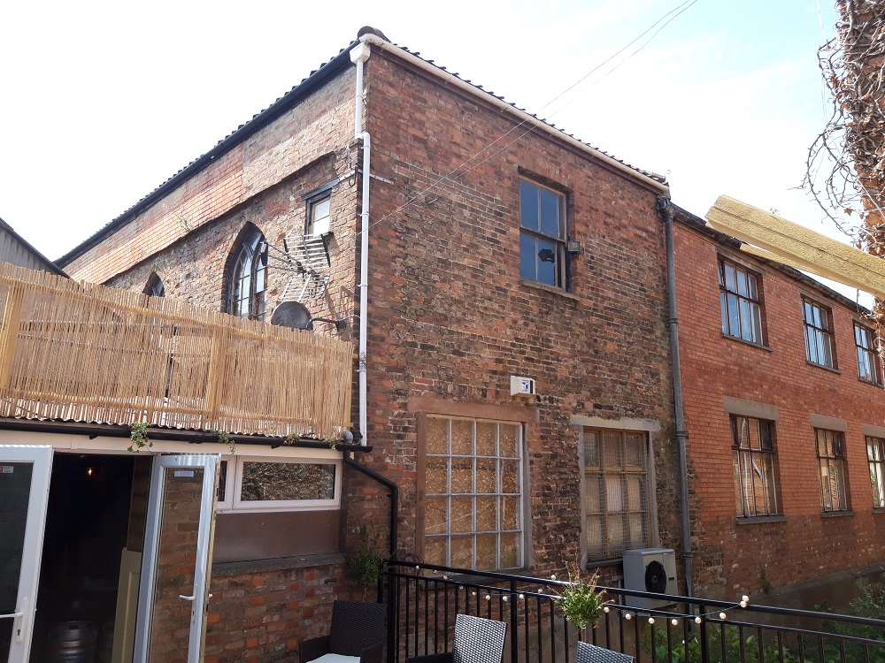
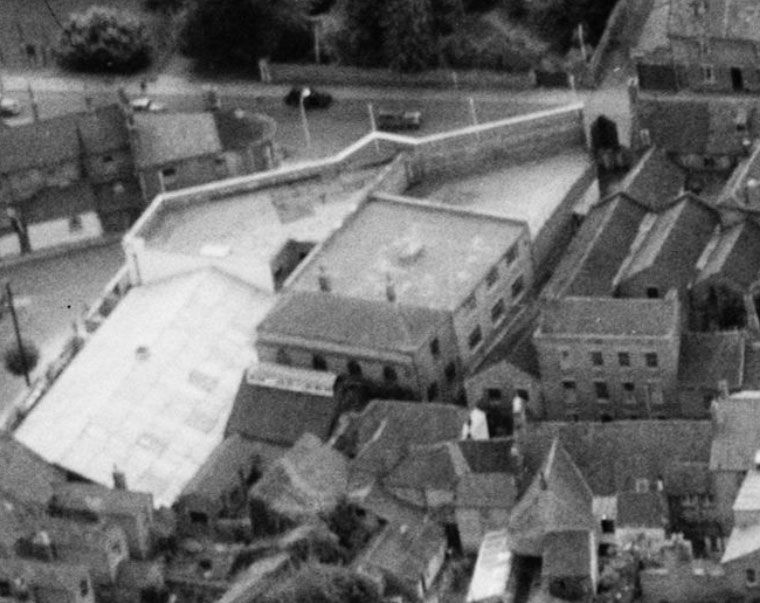
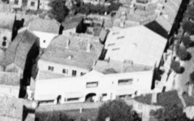
As can be seen from the aerial photograph from 1932 (below) this portion seems to be an extension to an older U-shaped house, although both incorporating the pointed gothic windows. The extension seems to have been added by the time of the 1854 map below.
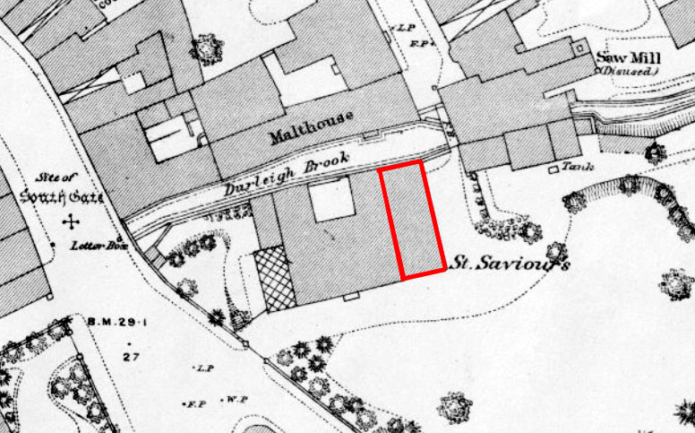
The pointed windows seen on the older portion of the house may be a very early example of the Gothic Revival, inspired by Strawberry Hill. These architectural gothic nods may have been made in reference to the old chapel (if it was the building closest to the road), and that chapel may have been incorporated as part of the house.
It is unclear who built St Saviour’s House. The 1810 map shows the house had a tight rectangular garden and did not incorporate the nearby field. The 1840s Tithe Apportionment survey mentions the adjoining field to the east and south of the property as ‘Field 196 in Bridgwater parish (Name=‘River Ground’ Cultivation=‘Pasture’ Owner=‘Symes Edward Shephers and others’ Occupier=‘Gabriel Stone Poole’ Acreage=‘2a 3r 0p’ Rentcharge=‘£0/2/1’ )’. It is pleasing to see the Poles/Pooles still living nearby! By the 1824 map (see above) the garden had been extended south to form a large triangle.
In 1837 a ‘late Edward Symes of St Saviour’s Bridgwater’ is mentioned when his son John married in Bristol (Bristol Mirror, 20 May 1837). This is possibly Edward Symes 1773-1823, buried 26 November in St Mary’s Churchyard, or his like-named son, Edward Shepherd, born in 1805 and baptised in St Mary’s that September. An Edward Symes of Bridgwater, solicitor, is mentioned various times in the local press through the 1810s and 1820s (Bristol Mirror 1 January 1820) and in 1821 an Edward Symes sold his ample house in George Street, which may possibly represent a move to St Saviour’s (Bristol Mirror 6 January 1821).
By the time of the 1854 Town Plan a new building near the Town Mill seems to have been added (most likely part of the mill complex), and part of the triangular garden carved off for redevelopment. A large rectangular extension to the garden had been added on the river side.
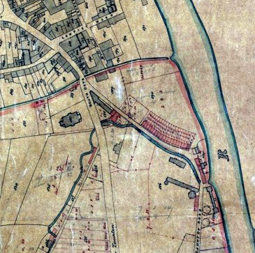
In 1861 the house seems to have been occupied by Robert Russell Sewell, a General Practitioner from Essex, and his assistant William Harnell from Ireland. Both were aged 42 and had two servants Jane Bosley and Gilbert Francis Morley. The next property in the street was the Free Reading Room, which is possibly 2 Old Taunton Road.
In 1883 a Frederick Farmer lived in St Saviour’s (Kelly’s Directory). Born in 1824 in Suffolk, he was a surgeon in the Bridgwater Infirmary, and a Justice of the Peace. He was living in Bridgwater by 1862 at least, although it is not clear where he made his home (Taunton Courier and Western Advertiser, 10 December 1862). He took his own life on 22 September 1885. Looking back at the 1881 census we find Frederick, his wife Emma and they were joined by Fanny Maxwell ‘a black immigrant lunatic’ and Elizabeth Denman, Fanny’s attendant. There also lived there a domestic servant, Hannah Hardwell.
After Farmer’s suicide, a T.L. Laxton took up the practice and took on St Saviour’s House.
We see the house and grounds in greater detail on the 1887 OS 25″ Map:
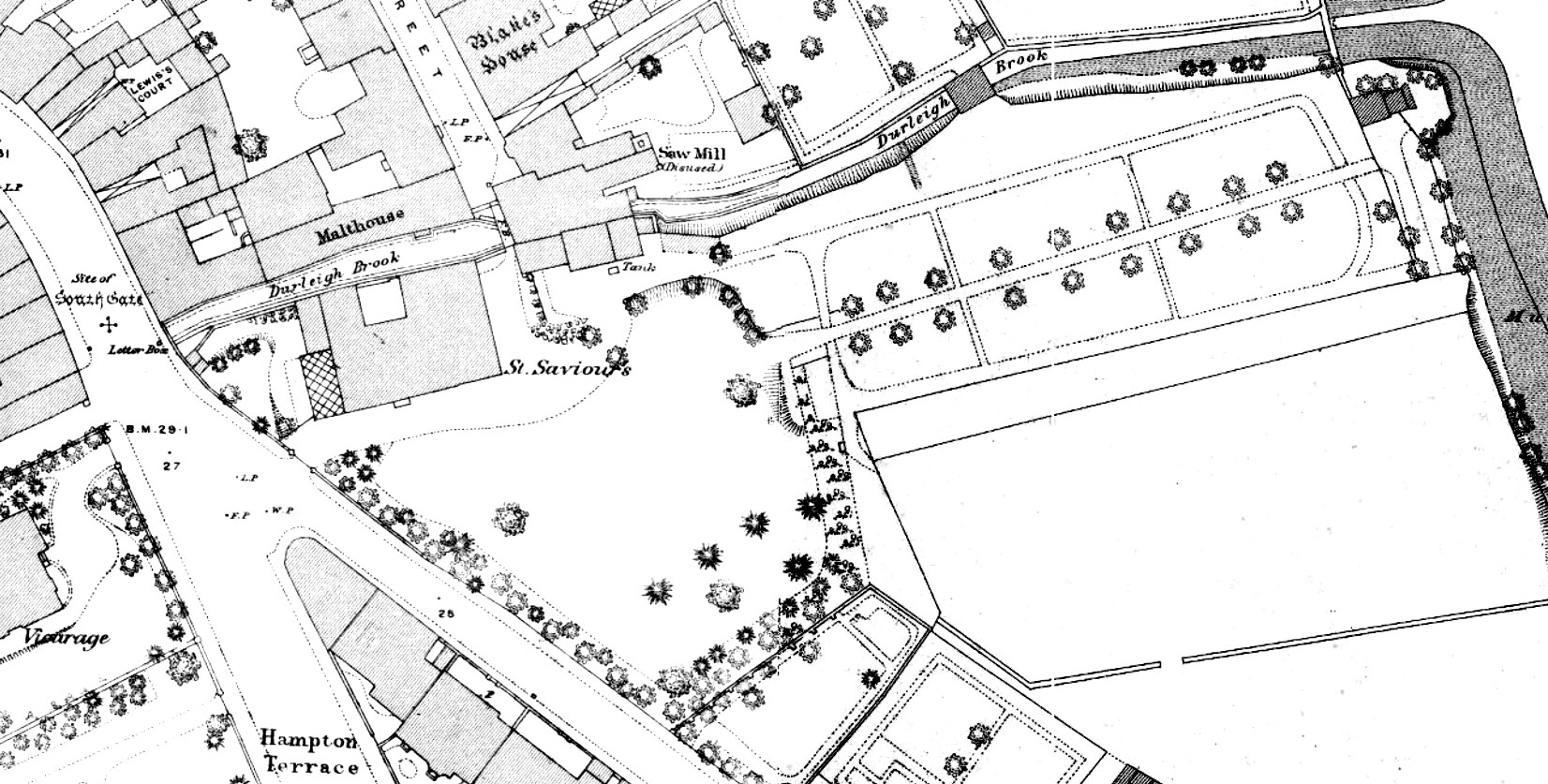
In 1892 there is notice of the sale by Robert Squibbs of furniture being sold from St Saviour’s House as T.L. Laxton, MRCS LRCP, would be leaving Bridgwater ‘in consequence of change of practice’ (West Somerset Free Press, 20 February 1892; Wells Journal, 3 March 1892). It is possible that the building work in the adjoining field prompted the move (see below). A stir was created in Bridgwater when Mrs M.L. Laxton took her own life by drowning only a couple of years later in Southampton (Bath Chronicle and Weekly Gazette, 10 January 1895).
The practice and house were then taken on by Randolph Henry Felix Routh MRCS LRCP. In 1895, 1899 and 1900 three of his sons were born there (West Somerset Free Press, 13 May 1899). In the 1901 census we see Henry, aged 38 of Middlesex, surgeon, his wife Jean, aged 36 of Scotland and the three boys, Charles, Douglas and Walter. There were three servants, housemaid Emma Jane Baker; cook Clara Jane Williams and nurse, Lilla A. B. Millard. In about 1904 Routh moved the practice to Malvern House on Taunton Road, severing the link between St Saviour’s and the medical profession. Routh died in 1949, living in Durleigh Road and was buried in the Wembdon Road Cemetery (Taunton Courier and Western Advertiser, 11 June 1949).
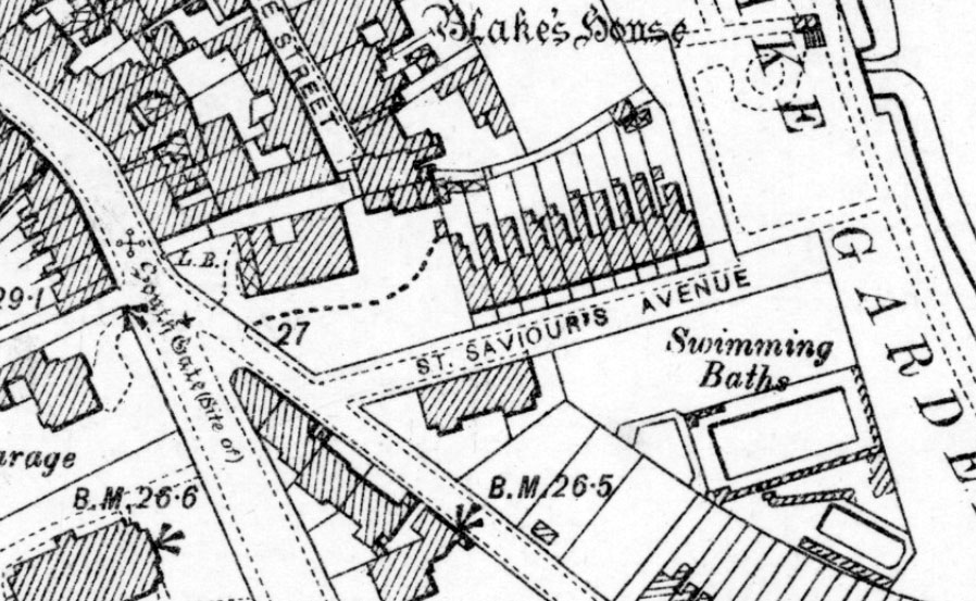
By the time of the 1904 OS 25″ Map, much of the gardens had been redeveloped into St Saviour’s Avenue, and a chunk incorporated into Blake Gardens.
The Parkers
From at least 1905 to at least 1908, St Saviour’s was the home of Walter Matthew Parker (1872-1921). He was married to Frances Beatrice Deane (1873-1879). In 1901 they had been living in Twickenham, in 1903 in Horwood Devon, and by 1911 they had moved on to Penzance, where Walter was now a clergyman in the Church of England. He does not seem to have been involved with the church during his time in Bridgwater. The first we find of them is a noticed in the Taunton Courier and Western Advertiser for 26 April 1905: “BIRTHS- PARKER 18 April at St Saviour’s House, Bridgwater, the wife of Mr Walter Parker, of a daughter.”
This was Beatrice Mary Parker, born 18 Apr 1905, baptised 17 Jun 1905 at St Mary’s church. Father Walter Matthew Parker (profession: gentleman) and mother Frances Beatrice Parker. We next hear of them in the Exeter and Plymouth Gazette of 15 December 1905: “NURSERY GOVERNESS wanted for young children: good references. Apply full particulars Mrs Walter Parker, St Saviour’s House, Bridgwater.”
The next we hear of them is in the Central Somerset Gazette for 17 January 1908, when a County Ball was held in the Town Hall Bridgwater. Mrs F. Beatrice Parker of St Saviour’s was the honorary secretary. The committee included a Mr Percival Parker and Mr Walter Parker.
Attending as a group on the actual evening were Mr C.P. Parker, Miss Parker and Mr and Mrs Walter Parker.
C.P. Parker was Charles Percival Parker (1874-1948). He seems to have been a major in the Dragoon Guards, at least at the time of his marriage in Bideford in 1927. That was to the widow of his brother, Frances Beatrice Dene, mentioned above.
While Walter and Frances lived in Bridgwater, Charles appears to have lived with them at St Saviours. In 1907 he contributed a testimonial to the Weigel Motors car brochure (published in 1908), having won a trophy at a 1907 Buncombe hill climb event run by Somerset Automobile Club (with thanks to Matt Rumney for bringing this to light).
After the Parkers, the Bouchers seems to have acquired the house.
Skating Rink
In 1910 there was talk of building a roller skating rink at St Saviour’s House by the Bouchier Brothers, although they faced stern opposition from the neighbours, including the vicar of Holy Trinity Church across the road (Wells Journal, 25 August 1910). However, they seem to have got their way, as the Skating Rink in Old Taunton Road was being advertised in 1914. This was probably when the low large brick building was added to St Saviour’s House, which runs along St Saviour’s Avenue.
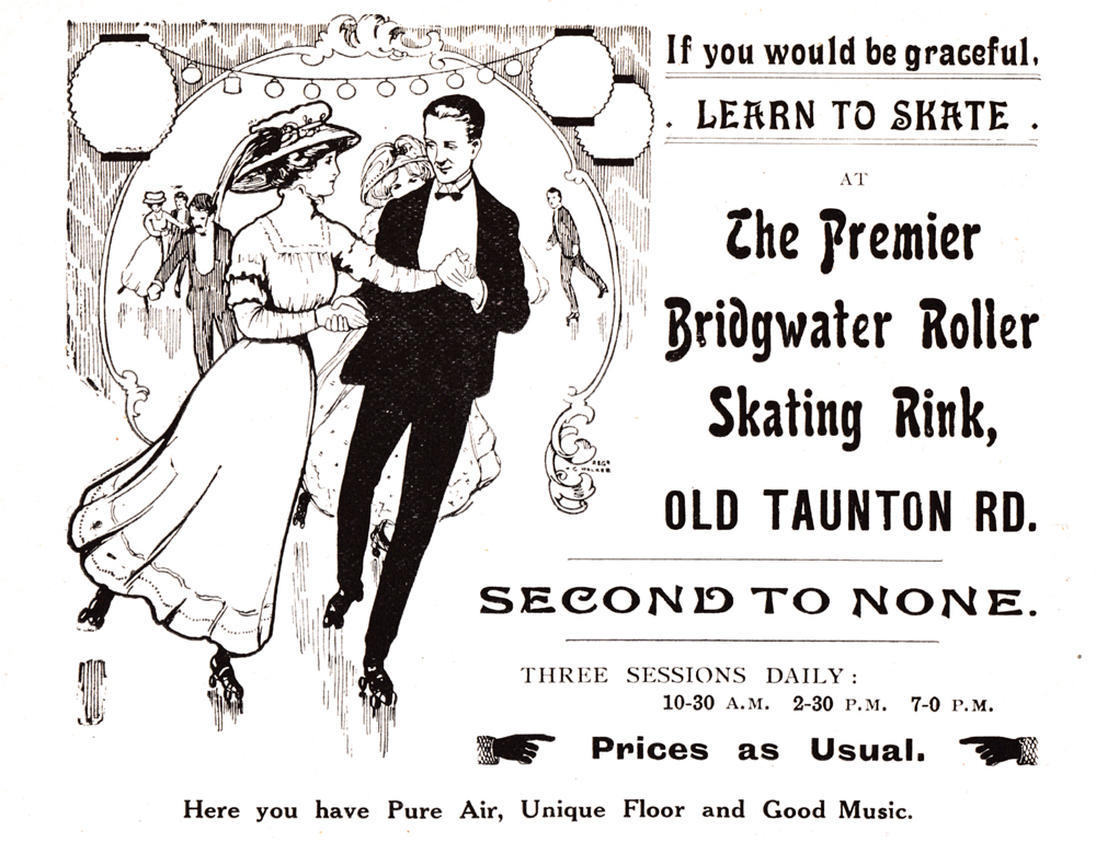
During the First World War this skating rink was turned over to the Red Cross as a temporary hospital. The local firm of Wills Engineers installed heating into the building (Western Daily Press, 21 August 1914).
Blake Hall
After the war the skating rink was used for manufacturing. In 1926, however, the site was redeveloped and turned into the Blake Hall. This was to be the headquarters of the Bridgwater Divisional Liberal Association and could hold 1000 people. Offices were included for the staff of the Liberal Association, presumably in the old house. The opening ceremony was held in June 1926, when the hall was opened by Sir Donald MacLean (Western Daily Press, 19 June 1926). In the following years the hall would be a popular venue for concerts and dances.
On the the 1930 OS map, we see the old St Saviour’s house incorporated into the new Blake Hall.

In 1932 we get a glimpse of the buildings of Blake Hall when aerial photographs were taken of the town.

Only three years later we see the new frontage erected along Taunton Road, which still stands today:

By 1953 the site had been redeveloped again, with a large square block built over a large portion of the old house. Further work needs to be done on the history of Blake Hall, but it is by this time old St Saviour’s House had been mostly redeveloped and forgotten.
MKP 28 September 2024
