Street names of Bridgwater starting with the letter ‘E’.
Earls Close: Modern NDR development, complete by 2006. One of a series of names taken from aristocratic titles. Built over a field called ‘Waverlands’ (TAM).
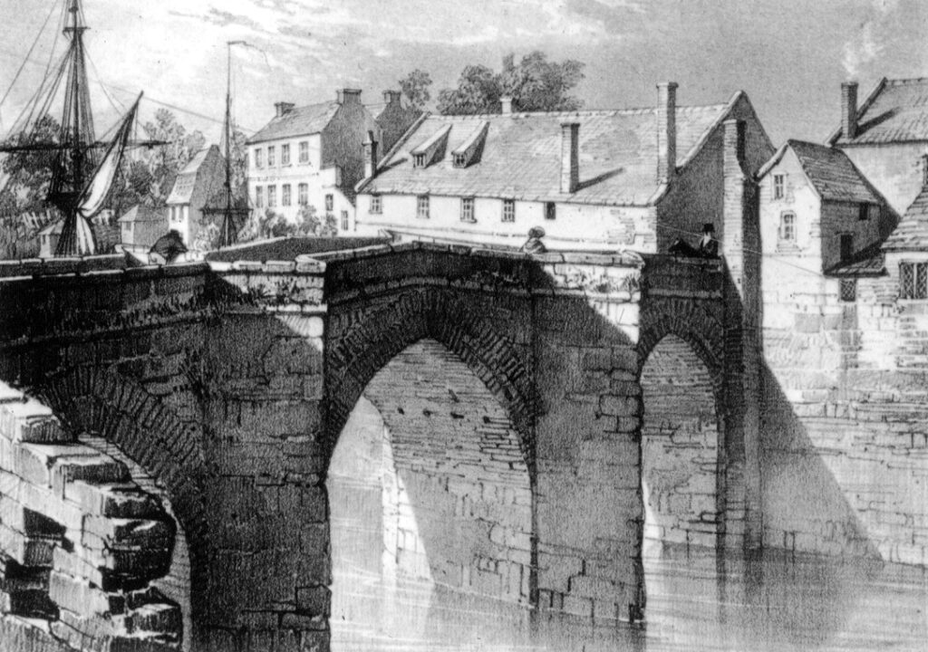
*East Quay: First described as ‘By the Were’ in 1366, a reference to the tide mill later converted into a dry dock (BBA, no.238). Bowling Green on Stratchey’s 1735 Map. Presumably referred to as East Quay from the early nineteenth century, when the east side of the river was first utilised as an additional quayside, after the demolition of a houses adjoining the old bridge, c.1800. Usually called ‘Eastern Quay‘ in early newspaper and census mentions, for example the 1835 Borough Property Report. Called East Quay on the 1889 OS Map. East Quay seems to have been considered to stretch far along the river bank as Barham’s Brickyard was referred to as on East Quay.

Eastern Avenue: the first portion of the Bower Estate, south most portion shown on the 1972 Town Guide plan. Little change by 1974. Extended considerably by the 1978 Town Guide Plan.
*Eastover: Over comes from an Old English word ‘ofer’ meaning riverbank, so Eastover means something like ‘East Bank’ (James Hill, The Place Names of Somerset, 1914. p.74). Called ‘Estovere’ in 1357 (BBA, no.184). Also called ‘ beyond the Bridge’ in the 1260s (BBA, no.23), ‘twixt the Hospital [of St John]and the Bridge’ in 1317 (BBA, no.80) or ‘east of the Bridge’ in 1326 (BBA, no.107)
Eastwood Close: Later part of the Sydenham estate – date TBC. Name of unknown significance. Presumably named in honour of someone, as there was no east wood in this area, being mostly marshland. The site of an orchard on the 1888 OS map.
Edinburgh Road: Shown under construction on the 1946 RAF aerial photographic survey, part of the second phase of the Rhode Lane Estate. As many of the names of the estate are from royal titles, this street is presumably a reference to the Duke of Edinburgh, a title granted to Prince Philip of Greece and Denmark in November 1948, which suggests when this street may have been nearly completed.
Edward Street: Named after Edward Sealey who owned much of the land in that area (MS). Site of an iron and brass foundry on the 1889 OS map. Initially laid out in 1860: ‘New streets are in the course of formation over eleven acres of ground belonging to Mr Vidal in St John Street, and in the rear of that thoroughfare. One street will run from Polden Street to the railway station yard, and another from the new road to St John Street. These two thoroughfares are being made, and other transverse streets are to be laid out’ Bridgwater Mercury 4 April 1860. We learn elsewhere in that edition of the paper that Mr Vidal was employing the workmen to build the scheme – a Mr Lilly was also involved, and that work on the Edward Street section of the scheme was already underway and causing a mess on St John Street. Mr Vidal’s full name was Edward Urch Vidal, and his mother (Eliza Urch Sealy) was widow of the Edward Sealy of Friarn House in question (Western Daily Press 03 September 1867). Vidal’s second daughter was called Margaret Sealy, and she is described as grandaughter of Edward Sealy (implying Sealy was Vidal’s father? Western Daily Press 3 September 1867)
Eight Acre Meadow: Part of the NDR development, under construction in 2006. Named after a nearby field, although not actually built on that field (which is the site of the allotments), ironically this road is partly built over Church Meadows, unlike the street on the same estate called Church Meadows.
Elder Close: Post 2006 Stockmoor Estate, date TBC. Presumably named after the tree type.
Eldergrove Close: (late 20th c. Bower development – date TBC) One of a series of streets in a development, each named after trees types. Marshland on the 1840s Tithe Apportionment map.
Eliza Way: Post 2009 Jam Factory redevelopment. Some streets on this estate took nautical names associated with the River Parrett. Named after a trow of 54 tons, built at Runcorn in 1865. Registered Bridgwater 1898. Captain J.William 1920. Registered as a barge 1936. Broken up 1949 (Reference Index) Unclear who Eliza was this ship was named after.
Elizabeth Way: Shown as a new addition to the map of the 1978 Town Guide. Along with adjoining Jubilee Close, this is presumably a reference to Queen Elizabeth II’s silver jubilee of 1977.
Elmgrove Close: (late 20th c. Bower development – date TBC) One of a series of streets in a development, each named after trees types. Marshland on the 1840s Tithe Apportionment map.
Elmside Road: Shown under construction on the 1946 RAF aerial photographic survey. Part of the second phase of the Rhode Lane Estate. Hamp Wood on the 1840s Tithe Apportionment Map, open fields on the 1889 OS map.
Elmwood Avenue: Takes its name from Elmwood House, which dated to the 1850s, although that house was a little distance away on Hamp Street. The lane was laid out between the 1840s Tithe Apportionment map, and the pre-1854 Town Plan, linking Hamp Street to the New Taunton Road. It occupied the site of an older rope walk, shown on the Tithe Map. The adjoining Browne’s Pond was also dug between those dates. Called Browne’s Drive on the 1889, 1904 and 1930 OS Maps. Houses built between 1930 and 1949 (dates TBC).
Elmwood Villas: Hamp. A small terrace, numbers 1 to 4 Hamp Street. Presumably take their name from Elmwood House, which was opposite. Built sometime between the 1904 and 1930 OS maps. (with thanks to Peter Redding).
Embden Walk: Post 2006 Stockmoor Estate, date TBC. Presumably named after the place in Germany.
Emerald Way: Modern Little Sydenham Estate, post 2006 – date TBC. A number of roads on this estate are named after pretty stone types. Built over a field called Lower Blind Yeo (TAM), suggesting that this was the site of a silted up tributary or course of the Parrett – Yeo being a common river name, blind meaning it came to a dead end.
Esperia Drive: Post 2006 Stockmoor Estate, date TBC. Possibly refers to the part of Italy.
Evesham Drive: Part of the Wills Road ‘Quantock View’ Estate, which was being built from at least 1986 onwards (see Wills Road). Name of unknown significance.
