Street names in Bridgwater starting with the letter N.
Naples View: NDR development, part complete, part under construction in 2006. One of a series of names taken from places in Italy.
Navatrin Close: Post 2006 Stockmoor Estate, date TBC. Name of unclear significance.
Nelson Court: (1980s Docks development – date TBC) Named after famous admirals of the Royal Navy, keeping with the notion of ‘Admirals Landing’. Named after Horatio Nelson.
Nelson’s Place: a small terrace on the north/west side of Bath Road just before Union Street, shown on the 1887 OS 25″ Town Plan and mentioned in the 1891 census. Now 63 to 69 Bath Road.
Nepeta Walk: Post 2006 Willstock Estate, date TBC. Named after a type of plant.
New Road: Eastover. Does not appear on the 1853 or 1868 town plans. Appears on the 1889 OS town plan. Obviously the ‘new road’ when it was built, although why is a bit of a puzzle, as access to the north of Eastover was already supplied by East Quay. Possibly built in anticipation of the the Bridgwater North Railway Station, which was originally conceived as terminating much closer to Eastover than it eventually came. Record of a new house being built here 1885-6 (SHC, A/CMY/19). Mention of the ‘new road from Eastover’ in 1881 in relation to a fire there at the steam saw mill there, which had been built the previous year (West Somerset Free Press 23 July 1881).
Nicholls Close: Modern development, date TBC. Part of the medieval Northfields (TAM). Allotments on the 1946 RAF survey. Along with Furze and Phillips, this street was named after a former teacher/headmaster of the school. A Nicolls was apparently a Geography teacher there, while Miss Nicholls was headmistress before Miss Furze (with thanks to Molly Warren and Dawn Ferguson).
Nightingale Close: Westonzoyland Road Estate, laid out and built between 1961 and 1967 (Town Guide Street Plans). Built over an orchard of Dunwear Farm. Presumably named after the bird type.
Noble Street: Modern Little Sydenham Estate, post 2006 – date TBC. Little apparent significance: just a pleasing name to sound grand. Built over Sesland Orchard.
Nokoto Drive: Post 2006 Stockmoor Estate, date TBC. Name of unclear significance.
Nolana Court: Post 2006 Willstock Estate, date TBC. Named after a type of plant.
Norfolk Close: Westonzoyland Road Estate, laid out and built between 1961 and 1967 (Town Guide Street Plans). Names of unknown significance, although several in this area are named after English counties.
North Back Lane – See Northgate
North Back Street – See Chandos Street
Northern Distributor Road: See Homberg Way
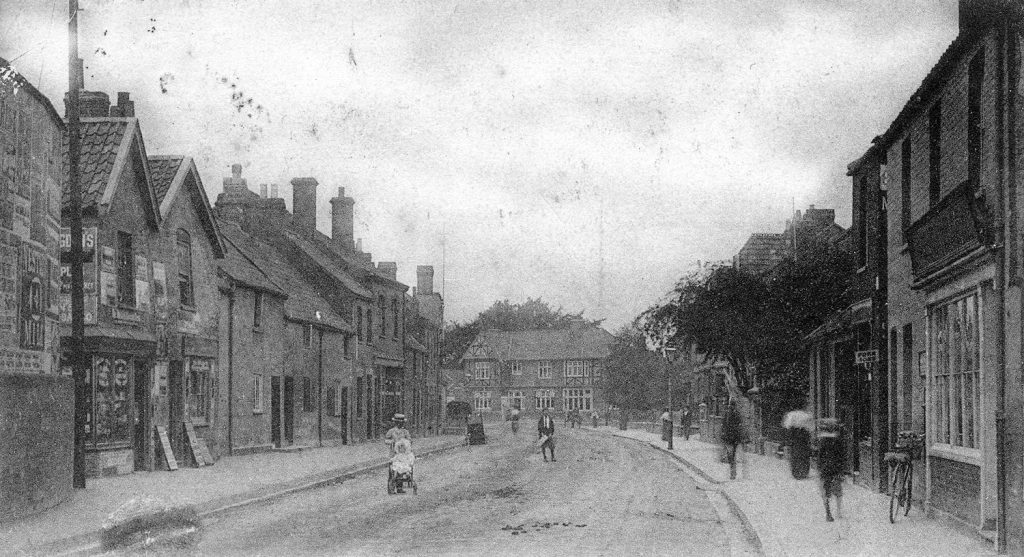
*North Street: First described as such in 1355 (BBA, no.175). Originally meaning as ‘the North Street Without the West Gate’, as opposed to West Street: at the same time the High Street was divided in two between South and North Streets. More usually known as ‘the Street to Keordesbury’ (Kidsbury) c.1300 and still called as much in 1365 (BBA, nos, 52, 165) and occasionally as ‘the Street to Wembdon’, as in 1322 (BBA, no.93).

North Street Terrace (or just North Terrace) appears on the 1889 OS Town Plan, running off of Southbourne Terrace and built over the back garden of the second house on the north side of West Street. Does not appear on the c.1854 Town Plan. Still standing in the 1937 Whitby directory, demolished by the 1960 Kelly’s Directory. Previously called ‘Poole’s Row‘ in the 1871 Census. Possibly built by Thomas Hutchings.
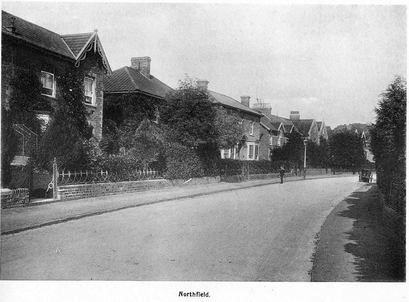
Northfield: One of the grandest streets for the Great and the Good of Victorian Bridgwater. Does not appear on the 1853 Round Map, but is on the Hawksley 1875 map. The name refers to the field it was built over, north to distinguish it from West Field (the corner of which is where the United Reform Church now stands). This was important agricultural land for the town in the middle ages. The original North Fields also incorporated the Cricket ground and Nicholls Close.

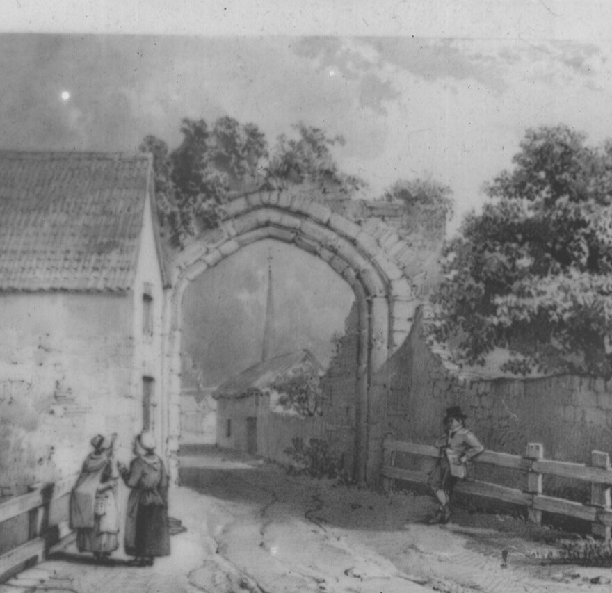
*Northgate: Not long after the town formed in 1200, defences were laid out in the form of the town ditch and four sturdy gates. These were as much for show as defence, as the town soon expanded beyond them. The first mention of the North Gate seems to come in 1352, when what is now called Angel Crescent was first mentioned: ‘twixt Northgate and Orlove Street’ (Orlove now Clare Street, BBA, no.165). The road outside the gate, vering sharply east before turning north, came to be known in reference to the gate. Mount Street is a nineteenth century addition, while the Clink extension dates to the 1980s. Of the Northgate itself, Jarman (1889) notes: The North Gate stood at a point outside King’s-square ; and inserted in the wall of a house immediately opposite the entrance gate to Blacklands and corresponding corner of the Girls’ National School is (or was) a square stone, inscribed “ Here stood the North Gate.” It was the earliest, to be removed. Also called ‘North Back Lane’ in 1735.

North Gate Cottages: a row of cottages on the northern side of the bend of Northgate. These appear on the 1824 Water Supply Town Plan. They appear to have been demolished by the time of the 1946 RAF photographic survey.
North Gate Yard. Invented in 2021. Of no historical significance but coined as a marketing gimmick, as ‘yards’ are fashionable.
North Terrace: See North Street
Number 1 Court, West Street: See Harding’s Court
Number 2 Court, Market Street: See Vearncombe’s Cottages
Number 1 Court, Silver Street: See Foster’s Court
Number 2 Court, West Street: See Tilly’s Buildings
Number 3 Court, Monmouth Street: See Dole’s Buildings
Number 3 Court, West Street: See Bailley’s Court
Number 4 Court, Market Street: See Knight’s Buildings
Number 4 Court, West Street: See Paine’s Court
Number 5 Court, West Street: See Long’s Court
Number 6 Court, West Street: See Milton’s Place
Number 7 Court, West Street: See West Street Place
Number 8 Court, West Street: See Harris’s Court
Number 9 Court, West Street: See Lewis’ Court
Number 10 Court, West Street: See Manchip’s Buildings
Number 12 Court, West Street: See Fursland’s Court
Number 14 Court, West Street: See Cook’s Buildings
Number 16 Court, West Street: See Tucker’s Court
Number 18 Court, West Street: See Bussell’s Buildings
Nursery Cottages: terrace of four houses built between Victoria Terrace and the Old North Pole Inn (Annie’s Bar in more recent times). Built sometime between the 1854 Town Plan and 1888 OS Town Plan. On the former the land they were built on was still part of the North Pole Inn. Presumably named after the North Street Nursury which was on the opposite side of the road, extending from 50 to 56 North Street and a large portion of Camden Road.
Nursery Terrace: Built between the 1889 and 1904 OS maps, and before the adjacent terrace in Kidsbury Road.
