Street names of Bridgwater starting with the letter Q.
Quantock Avenue: Early development off of the 1924 Quantock Road, from which this takes its name. Not yet started on the 1930 OS Map. Shown in the 1939 Town Guide. Mostly complete, aside from a few houses on the south west , on the 1946 RAF survey.
Quantock Road: Named as the route towards the Quantocks. Intended as a bypass for the steep hill of Wembdon. Built as part of a public works scheme to ease unemployment in 1923-4 (Locke). Cemetery laid out 1928 (Squibbs). The name Quantock is of obscure origin, but is presumed to come from the Old Welsh for something like circle or rim (Ekwall).
Quantock Meadow: Modern, date TBC. Takes its name from Quantock Road. Built over a field called ‘Coles Eleven Acres’ (TAM). A large Cow Pit was once on the site of number 4.
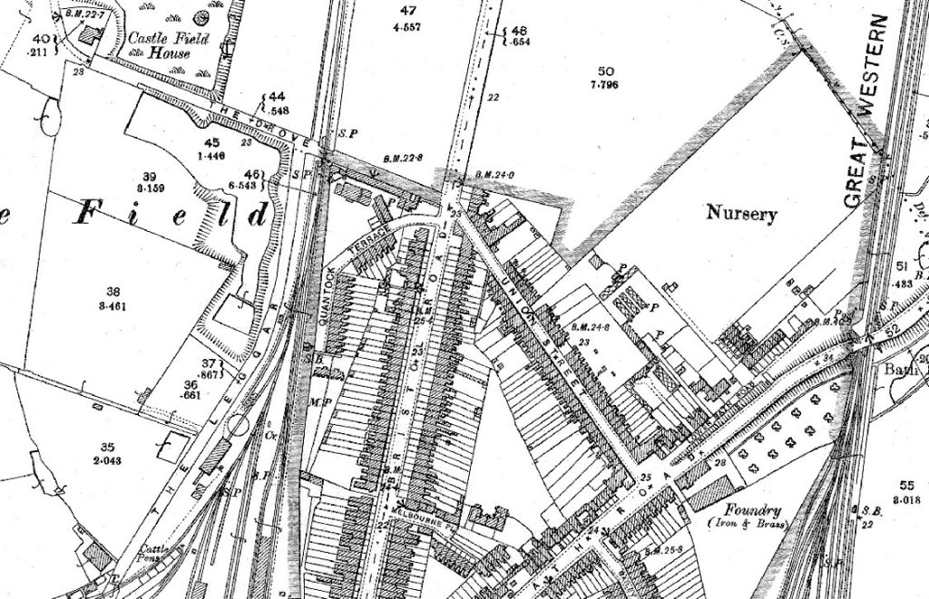
Quantock Terrace: The east part of this street was originally part of the Leggar (see that entry), which was divided off with the construction of the Somerset and Dorset Railway line in 1890. Terrace housing had been built here by the 1904 OS Map. The west part was built sometime after the removal of the railwayline – it does not follow the route of the diverted Leggar. Presumably named for providing a view from the Bristol Road of the Quantock Hills in the distance.

Quantock Way: Modern, date TBC. Takes its name from Quantock Road. Built over a field called ‘Coles Eleven Acres’ (TAM).
Quantock View: See Wills Road.
The Quay: See West Quay. For Back Quay, see Binford Place.
Quayside: Part of the 1980s (TBC) Docks development, a reference to the quayside of the docks.
Queen Street: Does not appear on Stratchey’s Plan of 1735, but he made known omissions of existing features. May have existed at this point as a trackway – an entrance that now forms Court Street is shown. Possibly an older trackway within the old castle Lower Bailey. Possibly preserves the line of the curtain wall of Bridgwater Castle – the shadow of the Castle Salthouse is still preserved in walling here, meaning part of this street will predate Castle Street of the 1720s. Possibly the street referred to as ‘the lane behind the coffee house‘ by the Duke of Chandos in 1727 (Baker & Baker, The Life and Circumstances of James Brydges, first Duke of Chandos (Oxford University Press, 1949), p.229). With Court Street, called Coffee House Lane on the 1810s Town Plan. Seems to have briefly been called Victoria Street. Several people and institutions are described as in Victoria Street in Robinson’s 1839 Directory. These seem to correspond to the same people in Coffee House Lane in the 1841 Census (with thanks to Mike Searle). By the 1887 OS Town Plan, Court Street and the eastern portion of modern Queen Street were Queen Street, while the western portion was still Coffee House Lane. By 1904, Queen Street and Court Street had settled to how we know them now. If named as a counterpart to King Square in 1807, then this would be Charlotte of Mecklenburg-Strelitz. However, if the Queen Street name is related to the brief Victoria Street, then it may be Queen Victoria.
Queens Road: Part of the Rhode Lane housing estate. Not on the 1930 OS map, but appears in the 1939 Town Guide. Shown complete on the 1946 RAF survey. Named after Queen Elizabeth, consort of George VI.
Queenswood Lane: The 1840s Tithe Apportionment Map appears to show that the old Queen’s Wood was on the southern slope of the hill, bounded between what is now Queenswood Lane and the Durleigh Road, although may once have been much larger in extent. The lane is shown on the map and is named on the 1889 OS map. The west of the lane is ‘Skimmerton’, possibly a deserted village.
Queenswood Road: South portion shown under construction and nearing completion on the 1946 RAF photographic survey. Extended north as part of the cooperative housing estate between the 1961 and 1967 Town Guide plan.
