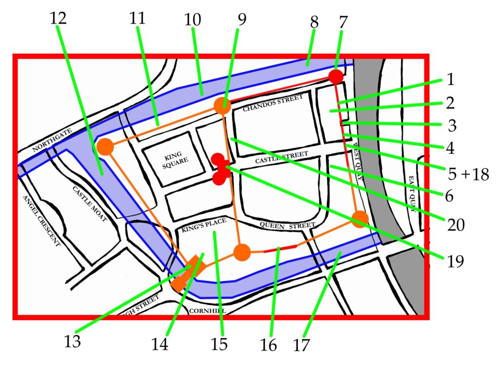
Use the map below to follow links regarding aspects of the Archaeology of Bridgwater Castle. This reconstructed map is conjectural. The outline of the moat is relatively easy to trace, otherwise much is open to speculation. The Red parts of the map are confirmed, while orange are assumed. More materials will be added over time as we learn more.

1……The West Quay Wall
2……The Bonded Warehouse
3…… The Watergate
4…… Castle Wall south of the Watergate
5……The Castle Wall below Castle Street
6……The Castle Salthouse, Queen Street
7……Corner Tower and Burial Ground
8……The Northern Moat, Weir and Rhyne
9……Remains in King Square
10……The North Wall and Moat
11……Supposed Wall and Well
12……The Western Moat
13……The External Gatehouse
14……The Back of the Post Office
15……Location of the southern wall
16……The Queen Street Walls and Cellars
17……The Southern Moat
18……The Culvert
19……The Internal Gatehouse
20……Crowpill Lane Fireplace
Miles Kerr-Peterson 2010. Revised 2016.
Also consult the materials held at the Somerset HER.
