Before Binford House: 1313-1741

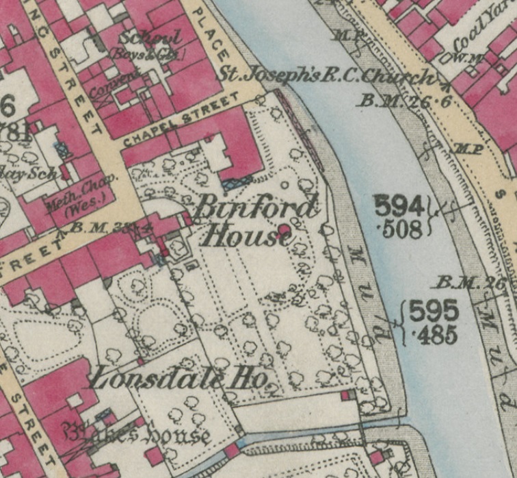
The large area of ground that came to be occupied by Binford House appears to have been made up of several medieval properties and ‘Frog Lane’. It is not especially clear exactly how many were merged together over the centuries, as the available evidence is thin.
The way now called Chapel Street is an oddity, as it seems strange for the medieval planners not to have continued what is now Dampiet Street in a straight-ish line all the way to what is now Binford Place: there seems little obvious reason why there is such a pronounced dog leg.
Let us try and pin down what was going on.
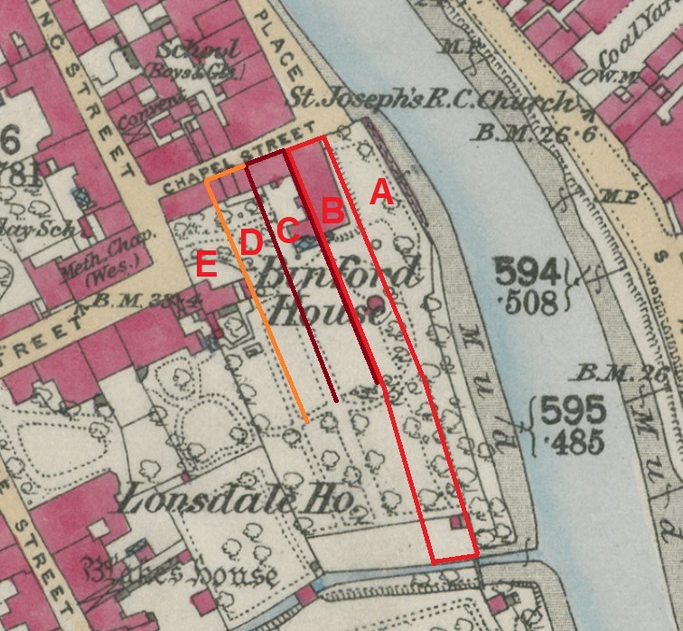
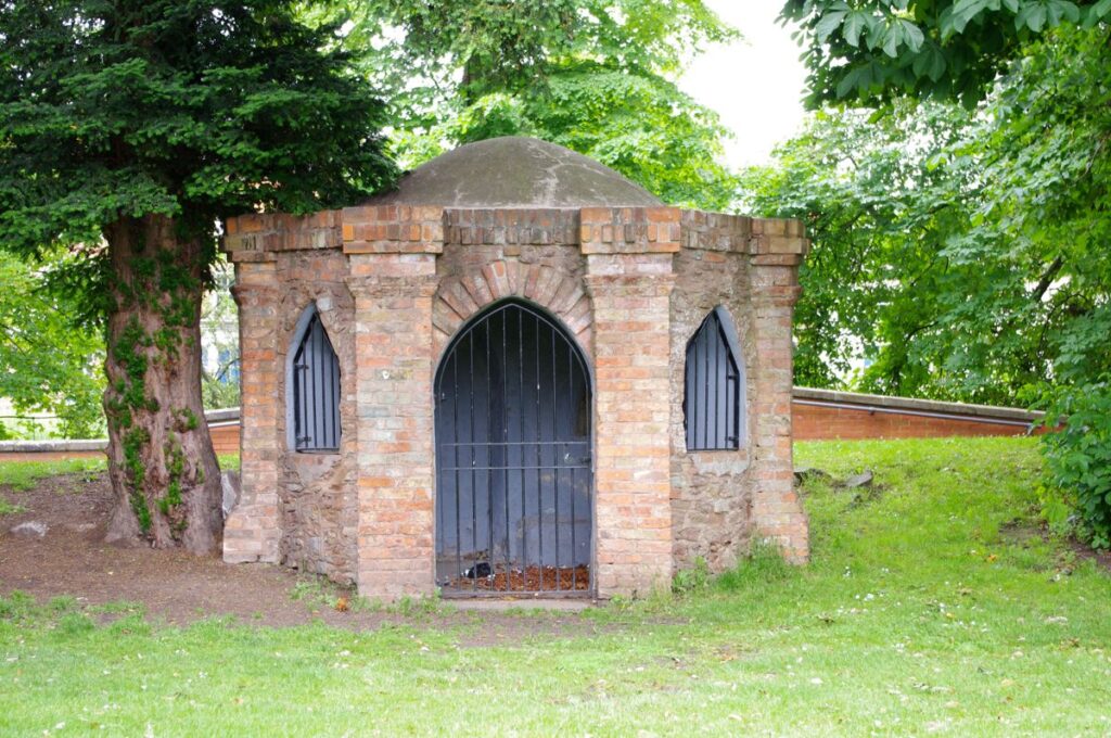
In a report on the property owned by the Borough Corporation from 1836 we learn that the piece of ground, a ‘half burgage’, on which the Blake Garden’s ‘turret’ summer house stood, was once called Frog Lane – labelled A below. That led from Chapel Street all the way to the Durleigh Brook. To its east was a strip of land belonging to Thomas Symes (A), which fronted the river, and on the west (C) were lands in the possession of Henry Harvey. A burgage is best thought of as a strip of land, leading off of a street, of a certain width, but varying length. Most properties in Bridgwater were half burgages.
When we look at the medieval property records of Bridgwater we learn that Frog Lane was also the name for what is now Binford Place. We learn this from a few documents, such as one from 21 January 1313, where a half burgage was granted by Roger Broune to Richard Wylde. This was in Frog Lane and was described as between the tenements of Richard of Heues on the north and another property owned by Richard Wilde on the south. These documents do not distinguish between the east or west side of Frog Lane, which was usual when referring to streets with properties on both sides. Combined with the knowledge that the properties at this part of Frog Lane run east to west, this can only relate to Binford Place, which fronts the river. That Frog Lane continued further south than Binford Place, but not quite aligned with the part further north was not unusual; George Street’s continuation into Blake Street has a kink in the same way.
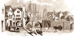
We learn more from the medieval documents. On 31 May 1396 Roger Wyldsmyth and his wife Christine leased the income of a property they held to John Looff. This property (C on the map below) was situated on a certain street called Damyet (ie Dampiet, this part now being Chapel Street), which had the ‘common way’ leading to ‘Froggelane Brigg’ on its east side and a tenement held by Thomas Asschull on the west. The common is probably the Frog Lane mentioned above, stretching from Chapel Street to the Durleigh Brook. It is not clear if the Wyldsmyth property extended all the way from Chapel Street to the Durleigh Brook, as its southern boundary is undefined. This 1396 document tells us that the adjoining Frog Lane (B) led to a bridge, called Frog Lane Bridge. We might assume that this crossed the Durleigh Brook, although where it led afterwards we can only speculate at. It is possible that it joined up with the Old Taunton Road by the river, although as most of the major routes out of the town had fortified gates (St Mary Street/Old Taunton Road had the South Gate), it would be odd to have a bypass. It may be that Frog Lane Bridge just led to the fields on the opposite side of the Durleigh Brook. Other medieval documents mention a mysterious structure called ‘Lyme Bridge’, which the Town Council was regularly repairing, notably in 1457, 1460 and 1461. In later centuries there were Lime Kilns on both side of the Parrett to the south of the town, so there may have been a kiln on the opposite side of the Durleigh Brook.
An earlier document of 19 October 1344 details a property (D on the map below) given by Thomas Fichet, Lord of Spaxton, to the wardens of the chantry of the Blessed Virgin Mary in St Mary’s Church. This was for a tenement and its pertinents ‘which is in the street called Damyetestrete, close to Vroggelanesbrigge, on its north side’. The mention of the bridge being close is perhaps more of an indication of which end of Dampiet Street is being referred to (ie not the St Mary Street end), rather than it adjoining that part of the road. The length of this property is described as between the tenements belonging to John Purchatz and Thomas the Porter. The southern boundary of the property adjoined the dwelling that Walter of Estone held from Fichet. Exactly how Estone’s property was accessed is a bit of a puzzle, as there was no obvious access way, unless there was access via one of the other properties nearby via a lane.
From these documents we can start to overlay the properties later taken over by Binford House. Frog Lane is outlined in Red (B), the Wyldsmyth property in Burgundy (C), and then the Spaxton property in Orange (D). From this we see five clear burgage plots fronting Chapel Street.

Why did that part of Frog Lane disappear though? Presumably there was no more use for it, perhaps Frog Lane Bridge was removed, creating a useless dead end. A context for this may have been the creation of the town’s defences during the Civil Wars of the 1640s, when huge earthworks were erected around the perimeter of the town. The South Gate was heavily fortified, so perhaps Frog Lane Bridge was demolished and never rebuilt, while anything beyond the brook would have been flattened to create a clear field of fire.
The next documents we have comes from 1681, when we find the Frog Lane strip of land described as part of a horse mill (essentially where horses would walk round and pull a millstone to grind corn, or provide power from some machinery). This was purchased by the Balch family. From this we learn that this part of Frog Lane had ceased to exist as a functioning road by that time and it was used as part of a larger industrial site. Presumably the five burgage plots had started to coalesce, at least B and C, even if the underlying land was owned by different interests.
In 1701 we learn that the property closest to the river (A) was called ‘the Black Boy Inn’, which had two gardens, presumably one behind the other, a set-up which might explain the long length of ground between Chapel Street and the Durleigh Brook. The name ‘Black Boy’ probably comes from an advertising sign hung above the door, which was usually an indication that tobacco could be purchased within. Tobacco was produced in the Caribbean and American Colonies using slave labour, and it was common to use a slave boy as a symbol of tobacco in a semi-literate age.
After this we learn that the site closest to Damiet Street (E towards B) was used as a ‘soap boiling house’, which was acquired by the Binfords, with its stables and ash house. This had been acquired from Jonathan Vinicott ‘tinman, later wine merchant’, who had acquired the lease from James, Lord Waldergrave back in 1723. When Vinicott died in 1741 the Binfords acquired the lease.
On Thursday 19 April 1804, the Bath Chronicle and Weekly Gazette described the sale at auction of ‘that large Inclosed Garden, that of Mr. John Leaker, yearly tenant from Michaclmas, containing two acres more or less also that building called the Turret, and all those three Stables and Coach-House, in the occupation of Mr. Robert Anstice, and others, as yearly tenants from lady-Davy… The Turret, and about 15 1/2 feet of the east side of the Garden, running north and South, are Leasehold, held under the Corporation of Bridgwater, for three good lives. Possession may be had at Michaelmas next.’
By this time all five plots seem to have come together into the site of Binford House and its large gardens.

Sources
- Published Bridgwater Borough Archives vol 1 no. 139 and vol 2 no.481
- Bridgwater Borough Archives held in the Somerset Record Office: DD/DP/93/5; D/B/bw/ML/8; D/B/bw/ML/1
- Thursday 19 April 1804, the Bath Chronicle and Weekly Gazette
MKP July 2019.
