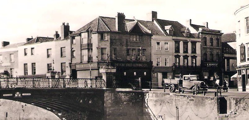
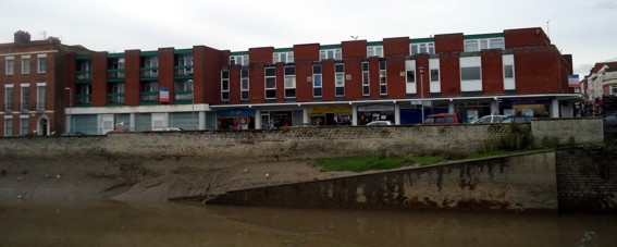
In August 1966 a row of old buildings along Binford Place were demolished to make way for a new development. This new structure had the aim of creating larger retail units with modern residential accommodation above, all within one comprehensively designed building. We learn from the Taunton Courier and Western Advertise of 26 November 1960, that the scheme was carried out by the West Somerset and East Devon Co-operative Society to build a supermarket. At that time the society had bought out the Fore Street Clothing Company and Lock & Sons drapers and outfitters to own numbers 1, 3 and 5 Fore Street, along with 1, 2 and 3 Binford Place. They acquired further properites over the following years. The report states ‘the society plan to pull down the whole block of property and re-develop the site. The premises have a frontage of nearly 80 feet to Fore Street and 70 feet to Binford Place’. They would later almost double the frontage on Binford Place. The society was keen to build a ‘supermarket or comprehensive food hall’ on about half of the site, then ‘the rest of the site will probably be used for an outfitting and drapery business and a shop for radio, television and electrical goods’. The scheme would eventually see the selling of the Co-operative society’s grocery shop and offices in King Street. The King Street side of the development was set aside as an unloading space for vehicles.
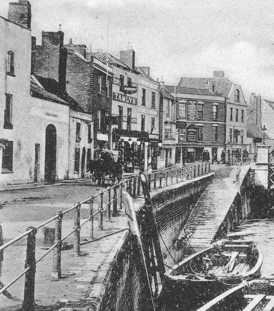
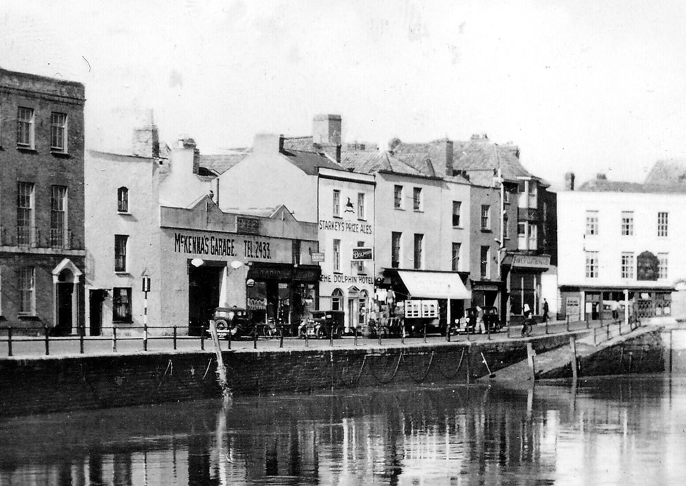
As well-intentioned these ideals were, sadly the development destroyed a good deal of the historic river front, sweeping away the medieval property boundaries and erasing a local character, replaced it with a rather non descript building which could be found in any town in the country. Binford Place is one of the original medieval streets of Bridgwater. It its name has changed several times, although for most of its history it was simply known as the Langport Quay or Back Quay. It was eventually named Binford Place after Binford House, which was situated where the Carnegie Library stands today. The house was named after James Binford, who died in 1717 and owned a property on that spot.
This map shows the extent of the demolition in 1966:

We can then look at each property in turn:
The Development of Binford Place
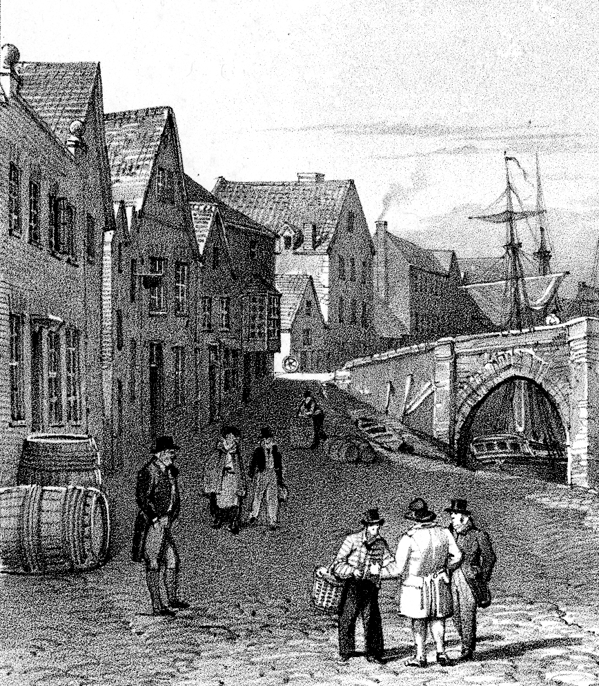
The oldest view of Bindford Place can be seen here. This watercolour by John Inigo Richards, made sometime in the second half of the eighteenth century, shows a two storey warehouse standing in front of the main row of buildings, splitting the street in two. This stood roughly where the road is now. Richards also shows the building known as the Arch, part of the Castle Inn, which was also drawn by John Chubb a few years later, after the warehouse had been demolished.

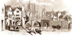
The Arch, a wonderful medieval structure, with Tudor and Jacobean additions, formed part of the establishment known as the Castle Inn. The Borough Corporation of the 1790s spent a considerable amount of effort clearing away many of the old medieval properties which had adjoined the stone bridge, partially to aid traffic, but also in preparation for a new iron bridge. The Castle Inn was considerably truncated, leaving a wall facing the river in brick, with the old stone frontage facing Fore Street.
References
Squibbs,P.,Squibbs’ History of Bridgwater (1982)
Lawrence and Lawrence, A History of Bridgwater (2005)
Fitzhugh, R., Bridgwater and the River Parrett (1993)
